Quick Facts
- Top Scenic Loop: Pemetic Mountain Loop, Acadia National Park
- Best Waterfall: Moxie Falls, The Forks
- Best for Solitude: Whitecap Mountain, Rumford
- Ultimate Challenge: Mount Katahdin, Baxter State Park
- Family Favorite: Jordan Pond Path, Acadia National Park
- Technical Note: The Precipice Trail involves a 0.9-mile climb that ascends approximately 1,000 feet and is usually restricted during falcon nesting.
- Western Maine Vista: Rumford Whitecap Mountain features an elevation of 2,214 feet within a 1,120-acre preserve.
Maine's landscape is a rugged tapestry of coastal headlands and boreal forests, offering some of the most diverse trekking in the Northeast. Whether you are seeking the iconic vistas of Acadia or the remote silence of the western mountains, finding the best hikes in Maine requires a mix of local knowledge and logistical planning. The best hikes in Maine for scenic views include the Pemetic Mountain Loop in Acadia National Park, which offers vistas of Jordan Pond and coastal headlands, and Whitecap Mountain near Rumford, known for its open granite ledges and wild blueberry patches. For those seeking remote wilderness, the Turtle Ridge Loop in Nahmakanta provides clear views of Mount Katahdin and the surrounding boreal forest.
Pemetic Mountain Loop: The Acadia Crowd-Cutter [1,247 FT]
- Distance: 4.4 miles (loop)
- Elevation Gain: 1,033 feet
- Estimated Time: 2.5 - 3.5 hours
- Difficulty: Moderate to Strenuous
If you have ever stood at the base of the Beehive or Jordan Pond Path during the peak foliage season, you know that Acadia National Park can feel more like a bustling city than a wilderness retreat. However, the Pemetic Mountain Loop serves as one of the premier quiet hiking alternatives to Acadia National Park crowds. While the masses are queuing for popovers, you can ascend through a varying landscape of dense evergreens and open rock faces.
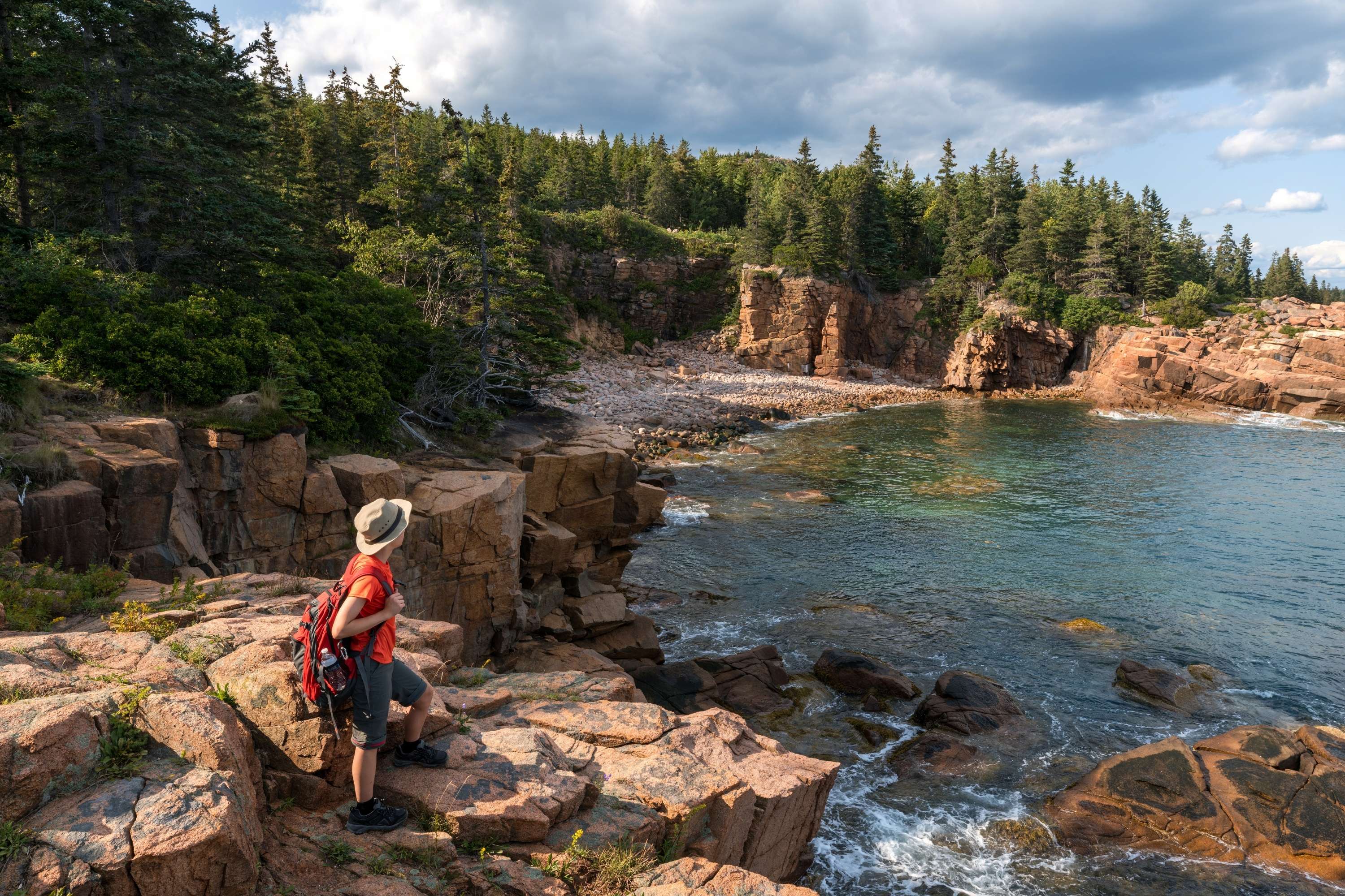
The trail provides some of the most spectacular ocean-view hikes in the region. Upon reaching the summit, you are rewarded with an unobstructed view of the Cranberry Isles and the Atlantic Ocean stretching toward the horizon. The descent often leads you toward the northwest, where the shimmering surface of Jordan Pond provides a cooling visual contrast to the rugged granite.
Safety is paramount in this area. While Pemetic is less vertical than its neighbor, the nearby Precipice Trail remains a point of caution for many. It is a 0.9-mile climb that ascends approximately 1,000 feet and is typically closed between March and August each year to protect nesting peregrine falcons. When planning your trip, always check the current Trailhead parking availability at the Jordan Pond North lot, as it fills by early morning even on weekdays. Utilizing the Island Explorer shuttle is a strategic way to bypass the frustration of parking.
| Feature | Pemetic Mountain | The Beehive |
|---|---|---|
| Crowd Level | Moderate | Very High |
| Technical Level | Scrambling | Iron Rungs/Ladders |
| View Type | 360-degree Island/Pond | Near-vertical Coastal |
| Pace | Reflective | Fast-paced/Tourist |
Rumford Whitecap Mountain: Western Maine’s Hidden Gem [2,214 FT]
- Distance: 5.2 miles (out-and-back)
- Elevation Gain: 1,600 feet
- Estimated Time: 3 - 4 hours
- Difficulty: Moderate
Venturing away from the coast leads you to the best hikes in western Maine near Rumford, where the terrain becomes more ancient and the forests more whispering. Rumford Whitecap Mountain is an exceptional example of a high-reward trek that remains off the radar for most out-of-state visitors. The mountain rises to an elevation of 2,214 feet within a 1,120-acre preserve managed by the Mahoosuc Land Trust.
The true draw of Whitecap is the massive expanse of granite ledges that dominate the upper half of the mountain. Unlike peaks covered in dense canopy, Whitecap offers wide-open terrain that feels more like an alpine environment than its modest elevation suggests. This is a paradise for those who appreciate alpine vegetation and the resilient flora that clings to the cracks in the stone.
If you visit in the late summer, the mountain provides a culinary treat: wild blueberry patches. Hikers frequently pause on the sun-baked granite to harvest handfuls of these tiny, intensely sweet berries. From the summit, you can see the Sunday River ski slopes to the west and the silhouette of the White Mountains in New Hampshire. After the hike, consider visiting the local eateries in downtown Rumford to experience the authentic blue-collar charm of this paper mill town, which serves as the gateway to the western Maine mountains.
Moxie Falls: The Family-Friendly Waterfall Haven [90 FT drop]
- Distance: 2.1 miles (out-and-back)
- Elevation Gain: 210 feet
- Estimated Time: 1 hour
- Difficulty: Easy
Not every great Maine adventure requires a vertical scramble. Maine features several family friendly waterfall hikes in Maine with swimming holes that are perfect for younger children or those looking for a leisurely afternoon. Moxie Falls is a standout option, offering an easy one-mile hike to a 90-foot waterfall with accessible swimming holes. It is one of the highest and most impressive waterfalls in New England, yet it is reached via a wide, well-maintained Maine hiking trails guide approved path.
The trail snakes through a lush boreal forest, where the air is thick with the scent of pine and dampened earth. The sound of Moxie Stream guides you toward the climax of the trip, where wooden boardwalks and viewing platforms provide safe vantage points of the plunging water. Below the main drop, the stream pools into deep, clear glacial ponds that are safe for a refreshing dip on a humid July afternoon.
This area is located near The Forks, which is primarily known as the whitewater rafting hub of the state. It is an excellent side trip for those visiting the Kennebec or Dead Rivers. Another popular choice for families is the Blueberry Ledges trail in Baxter State Park, which combines a moderate forest walk with natural rock slides and pools at the trail's end, mirroring the aquatic fun found at Moxie.
Mount Katahdin: The Ultimate Northern Terminus [5,269 FT]
- Distance: 8 - 11 miles (depending on route)
- Elevation Gain: 3,800 - 4,500 feet
- Estimated Time: 8 - 12 hours
- Difficulty: Very Strenuous
For many, a Mount Katahdin hiking guide for first timers is a necessity because this mountain is unlike any other in the eastern United States. As the northern terminus of the Appalachian Trail, Katahdin is a pilgrimage site for hikers. It is widely considered one of the hardest mountain hikes in Maine for experienced backpackers, specifically due to the technical scrambles required to navigate the infamous Knife Edge.
The Knife Edge is a narrow granite ridge that shrinks to less than three feet wide in some sections, with thousand-foot drops on either side. It is not for the faint of heart or those with a fear of heights. Beyond the thrill-seeking, the mountain sits at the heart of Baxter State Park, a 200,000-acre wilderness where the wildlife—including moose and black bears—outnumber the humans.
Access is strictly controlled to preserve the wilderness character of the park. You must secure an advanced parking reservation for the trailheads at Roaring Brook, Abol, or Katahdin Stream. The climb takes you through various ecological zones, from the dense hardwoods at the base to the delicate alpine vegetation of the Tableland. On a clear day, you can look south and envision the 100-Mile Wilderness, the most remote section of the Appalachian Trail, stretching away into the deep green horizon of the Maine woods.
Decoding the Trail: Maine’s Navigation & Permits
Navigating the Maine woods requires more than just a smartphone. Many of the top rated trails in Maine are located in areas with zero cellular reception. Relying on digital maps can be a gamble, making paper maps and an understanding of the local marking system essential. Most trails use a color-coded blaze system: white blazes typically signify the Appalachian Trail, while blue blazes indicate side trails or local loops.
Logistics also play a huge role in the success of your trek. From the entrance fees at Acadia to the specific gate times at Baxter State Park, being unprepared can lead to a turned-around vehicle at the trailhead.
| Location | Permit/Fee Required | Best Season | Pro-Tip |
|---|---|---|---|
| Acadia National Park | Park Pass + Vehicle Reservation (Cadillac) | Sept - Oct | Use the free Island Explorer bus to save on gas and parking stress. |
| Baxter State Park | Day Use Parking Reservation (DSPR) | July - Sept | Book your parking exactly two weeks in advance at 7:00 AM. |
| Borestone Mountain | Small Entrance Fee (Audubon) | June - Oct | Visit the visitor center halfway up to learn about glacial ponds. |
| Mahoosuc Region | Mostly Free (Donations Welcome) | Aug - Oct | Bring a container for wild blueberries on the granite ledges. |
Weather safety is the final piece of the puzzle. Maine weather is notoriously fickle. A sunny day at the trailhead can turn into a dangerous lightning storm or a freezing fog within minutes on an exposed ridge. Always pack a non-cotton base layer and a waterproof shell, even in mid-summer.
FAQ
What is the most popular hike in Maine?
The most popular hike is undoubtedly Cadillac Mountain in Acadia National Park, especially the South Ridge Trail. Due to its status as the first place to see the sunrise in the United States during certain months, it attracts thousands of visitors. For those seeking height and challenge, Mount Katahdin is the most iconic inland peak.
When is the best time of year to hike in Maine?
The best time is generally from late August through mid-October. This window avoids the notorious mud season of spring and the black fly season of early summer. Additionally, the foliage season in early October offers world-class colors, though you should be prepared for cooler temperatures and larger crowds.
Where can I find family-friendly hiking trails in Maine?
Family-friendly options abound at Moxie Falls near The Forks and the Jordan Pond Path in Acadia. Both offer relatively flat terrain and high-value landmarks like waterfalls or iconic pond views. Blueberry Ledges in Baxter State Park is also a favorite for its natural rock slides and shallow pools.
Are there ocean-view hikes along the Maine coast?
Yes, Acadia National Park is the hub for ocean-view hikes. Trails like the Pemetic Mountain Loop, Gorham Mountain, and the Ocean Path provide constant vistas of the Atlantic. Further east, the Cutler Coast Public Reserved Land offers dramatic cliff-side trekking that rivals the best coastal scenery in the world.
Do I need any permits or fees for Maine hiking trails?
Requirements vary by location. Acadia National Park requires a standard park pass and some vehicle reservations. Baxter State Park requires parking reservations for its most popular trailheads. Private sanctuaries like Borestone Mountain Audubon Sanctuary charge a small fee per person. Most trails on state-owned public reserved land or land trust properties like Rumford Whitecap are free.
Exploring the Maine Wilds
From the salt-sprayed rocks of the coast to the granite cathedrals of the interior, Maine provides a lifetime of exploration. Whether you choose the best Maine loop trails with panoramic mountain and ocean views or the solitude of the western Maine hills, the key is to respect the land and prepare for its challenges. Maine’s trails are a gift of the past and a responsibility for the future; practicing Leave No Trace ensures that these vistas remain pristine for the next generation of trekkers. So pack your boots, check the weather, and head north to discover why these peaks have inspired poets and adventurers for centuries.