Quick Facts
- Top Recommendation: Gates of the Arctic National Park & Preserve for total wilderness immersion.
- Hardest Coastal Route: Beachfront Backpacking Trail in Chincoteague, where deep sand replaces solid ground.
- Most Technical Terrain: Mount Coe via OJI Trail, featuring slippery granite slides and dense Maine brush.
- Lowest Visitor Count: Gates of the Arctic recorded only 7,362 recreational visits in 2021, making it the most secluded national park in the system.
- Permit Alert: The Kalalau Trail in Hawaii remains one of the most strictly regulated, with overnight capacity capped at fewer than 100 people per night.
- Essential Gear: High-clearance vehicles for remote trailheads US and satellite communicators for areas without cell service.
Difficult uncrowded hikes in the US include the Beachfront Backpacking Trail in Virginia and the daunting wilderness of Gates of the Arctic. These secluded hiking trails offer technical terrain and backcountry solitude for advanced adventurers seeking to escape the 2026 tourist peaks.
Finding genuine solitude in the modern age requires more than just picking a long trail. As popular destinations like Zion and Acadia implement complex lottery systems and shuttle buses, the experienced trekker must look toward remote trailheads US locations that demand high-clearance 4x4 vehicles and expert-level navigation. These routes are not for the casual weekend hiker; they involve navigating through scree and talus, crossing unbridged rivers, and managing your own safety where there is no digital safety net.
1. Beachfront Backpacking: Chincoteague National Wildlife Refuge, VA
While most people associate Virginia hiking with the rolling hills of the Blue Ridge, the Beachfront Backpacking Trail offers a deceptive and grueling challenge. This 15.7-mile trek along the Atlantic coast offers no traditional elevation gain, but the physical toll of walking on loose, shifting sand for hours is equivalent to a much steeper mountain climb. This is rugged coastal hiking trails with high difficulty that rewards the persistent with views of wild ponies and the sound of the crashing surf.
Trail Snapshot: Beachfront Backpacking
| Detail | Specification |
|---|---|
| Distance | 15.7 Miles (Loop) |
| Elevation Gain | 68 Feet |
| Difficulty | Strenuous (due to sand and exposure) |
| Crowd Level | Very Low |
| Best Access | Fall and early Spring |
The challenge here is environmental. There is no shade, and the reflection of the sun off the water and white sand can lead to rapid exhaustion. Navigating this landscape requires careful tide monitoring and a heavy reliance on your internal compass, as traditional markers are often buried by shifting dunes. It is an off-the-beaten-path hiking guide favorite because of the absolute backcountry solitude found once you move three miles away from the main parking areas.
2026 Permit Warning: Overnight stays in the Chincoteague backcountry require a specific permit obtained through the visitor center. These are limited to prevent impact on the fragile dune ecosystem and the habitat of the piping plover.
2. Alpine Isolation: North Cascades National Park, WA
Often called the 'American Alps,' North Cascades National Park is a massive expanse of jagged peaks and over 300 glaciers. Despite its beauty, it remains one of the least visited parks in the lower 48. In 2025, the park saw only 46,925 visitors, a stark contrast to the millions who flock to the Olympic Peninsula. This makes it a premier destination for challenging secluded backpacking routes for summer trip planning.
Trail Snapshot: North Cascades Alpine Loop
| Detail | Specification |
|---|---|
| Distance | 12 - 30+ Miles (Variable) |
| Elevation Gain | 4,500+ Feet |
| Difficulty | Expert |
| Crowd Level | Minimal |
| Best Access | High-clearance 4x4 vehicle for Forest Service roads |
The terrain here is defined by glacial moraines and steep, vertical scrambles. Transitioning from the lush, temperate rainforest of the valleys to the stark, frozen world of the high peaks requires versatile gear and a calm head. For those seeking summit vistas without the long lines found on Mount Rainier, the North Cascades provide a raw, unfiltered alpine experience. You will likely spend more time checking your topographical maps than you will seeing other human beings.

3. The 4x4 Gateway: Gates of the Arctic, AK
If you truly want to test your limits, Gates of the Arctic is the final frontier. It is the least-visited national park in the United States, recording only 7,362 recreational visits in 2021. There are no maintained trails, no visitor centers once you enter the wilderness, and no cell service. Finding remote trailheads for experienced hikers here usually involves a bush plane or a long journey via high-clearance overland vehicles to the edge of the Dalton Highway.
Trail Snapshot: Arctic Wilderness Trek
| Detail | Specification |
|---|---|
| Distance | N/A (Route-finding only) |
| Elevation Gain | Variable |
| Difficulty | Extreme Technical |
| Crowd Level | Virtually Zero |
| Best Access | Late June to August |
Extreme remote hiking in Alaska means you are your own first responder. You must be proficient in offline GPS navigation and carry a satellite communicator at all times. The terrain consists of tussocks—small, unstable mounds of grass that make walking extremely draining—and icy river crossings that can change in depth within hours. This is the ultimate destination for those seeking difficult uncrowded hikes in the US.

4. High-Altitude Scrambles: Kings Peak, UT
In the Uinta Mountains of Utah, Kings Peak stands as the highest point in the state. While it is a popular summit for locals, its sheer distance—a 25-mile round trip—and the technical boulder scrambling required to reach the top keep the casual crowds at bay. This is one of the best secluded summit hikes for advanced trekkers who enjoy the adventure of arrival as much as the view.
Trail Snapshot: Kings Peak Summit
| Detail | Specification |
|---|---|
| Distance | 25 Miles (Round Trip) |
| Elevation Gain | 5,100 Feet |
| Difficulty | Strenuous / Adventure Scramble |
| Crowd Level | Moderate (at base), Low (at summit) |
| Best Access | 4x4 accessible trailheads for remote hiking trips |
The final approach to the summit involves a massive field of scree and talus. There is no clear path; you must choose your own line over house-sized granite blocks. High-altitude environments can trigger sudden weather shifts, so having a detailed topographic map and knowing how to read cloud formations is vital. The reward is a 360-degree view of the Uinta wilderness, stretching for hundreds of miles.
5. Mountain Verticality: Mount Coe via OJI Trail, ME
Maine’s Baxter State Park is famous for Mount Katahdin, but Mount Coe offers a quieter, steeper, and arguably more technical alternative. The OJI Trail is notorious for its verticality, gaining 3,375 feet in a relatively short distance. It features massive granite slides that become incredibly slippery when wet, requiring hikers to use hands, knees, and steady nerves.
Trail Snapshot: Mount Coe Slide
| Detail | Specification |
|---|---|
| Distance | 8.2 Miles (Loop) |
| Elevation Gain | 3,375 Feet |
| Difficulty | Technical Scramble |
| Crowd Level | Low |
| Best Access | Summer and early Autumn |
Hikers will navigate bogs and dense forest before emerging onto the open rock faces. Unlike the well-worn paths of the Appalachian Trail, the OJI Trail feels wild and unmaintained. This is where your commitment to Leave No Trace principles is tested, as the alpine vegetation is extremely fragile. The technical terrain demands sturdy footwear with superior grip to handle the steep granite sections safely.
Essential Logistics: Planning Your Remote Adventure
Stepping into the unknown requires a different level of preparation than a standard day hike. When you target difficult uncrowded hikes, you are often moving beyond the reach of traditional emergency services. This makes preparation your most important piece of gear.
- Communication: Always carry a satellite communicator. In deep canyons or dense forest, your phone is a paperweight.
- Navigation: Master the use of topographical maps and offline GPS navigation. Electronic devices fail, but paper maps do not run out of battery.
- Vehicle Access: Many of these remote trailheads US require high-clearance overland vehicles to bypass washed-out roads and deep ruts.
- Wilderness Permits: Research backcountry permits months in advance. For 2026, many parks are moving to purely digital lottery systems with 6-month lead times.
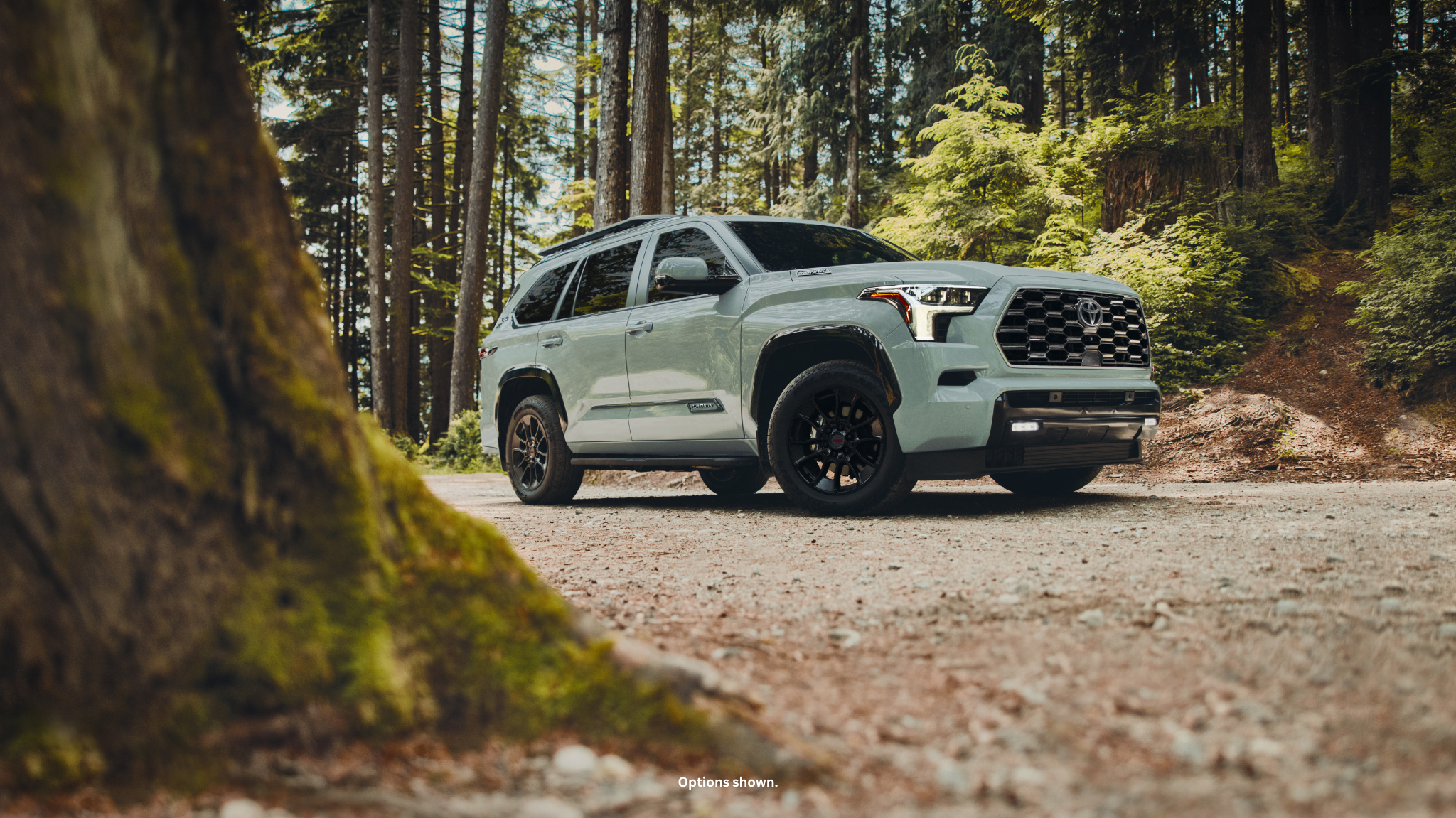
Seeking backcountry solitude on difficult uncrowded hikes is a rewarding pursuit, but it requires a reliable partner that can handle the long road to remote trailheads. Whether you are navigating the "American Alps" or the Alaskan tundra, your gear, vehicle, and skills must be up to the task.

FAQ
How do I prepare for a hike on a remote trail?
Preparation starts with physical conditioning and specialized gear. You should train with a weighted pack on similar terrain (sand, rock, or incline) and ensure you have all the ten essentials. Research the specific logistics of your destination, including water sources and current 2026 permit requirements.
How do you navigate a trail that is not well-marked?
Relying on a combination of offline GPS navigation and physical topographical maps is essential. You must be able to recognize terrain features such as ridgelines, drainages, and peaks to orient yourself when the physical trail disappears into scree and talus or dense brush.
Are there specific safety tips for wilderness hiking?
Always leave a detailed trip plan with a trusted contact who is not on the hike. Carry a satellite communicator for emergency SOS signals. Be prepared for self-rescue by carrying a comprehensive wilderness survival kit and knowing basic first aid for common backcountry injuries.
Do secluded hiking trails require special permits?
Many secluded hiking trails are located within protected wilderness areas or national parks that require backcountry permits to limit human impact. For 2026, verify whether your chosen route requires a permit via local ranger station websites or central reservation portals well before your departure date.
What are the risks of hiking on less-traveled trails?
The primary risks include delayed emergency response times, difficult route-finding, and encounters with wildlife that may not be used to human presence. Technical terrain like river crossings or granite scrambles can also pose a higher risk of injury when there are no other hikers nearby to assist.